|
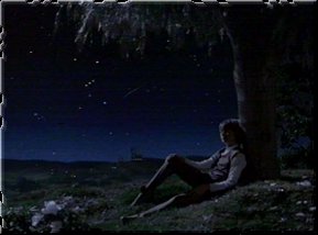
1.1.1 A glance at the stars ...
| Since human beings have been looking up to the starry sky at night, they have wondered how far away from us this small, twinkling lights which we call stars might be. At the beginning, they believed in an Earth located in the center of the universe and surrounded by sphere consisting of fixed stars, but over the centuries they've learned that the stars are farther away than we have imagined in our boldest dreams. To express their distances in numbers, new measures of distances that are based on light speed were introduced, but an imagination of this giant distances is even now, on the threshold of the 21st century, still impossible. While our sun is only 8 light minutes away from us, the light of the nearest star - Proxima Centauri - travels 4 years through space before it finally reaches our eyes. |
|
When Star Trek aired in America for the first time back in 1966, people were not only excited because of the intelligent science fiction stories, the plot that was embedded in a society based on mutual respect, equality and individual freedom and the implementation of the various aspects of the present human being in this futuristic environment (the so-called "mirror of humanity"). The fact that the intrepid crew of Captain Kirk explored the universe with the USS Enterprise as if it were the most natural thing on the world, together with the respect for the Unknown and the spirit to continuously push the final frontier surely increased the popularity of the series, too.
Undoubtedly - the universe is the playing ground of this greatest of all science fiction visions, because with the warp drive, all distances, with which you are confronted as a Star Trek fan day by day, can be covered within few days, weeks or months, in order to explore the Unknown and to discover new life forms and civilizations.
1.1.2 The task of the Star Trek Cartography
In a science fiction
series like Star Trek, of course science and technology are very important, and the
connection of the series to the old nautical traditions is obvious. Unfortunately, the
spatial localization of the shown voyages has always been regarded as a more or less
dispensable feature; in contrast to subspace, star dates and the history of the future,
the stellar cartography always remained a only very vague and often imperfectly worked out
aspect of Star Trek.
Hence, the Star Trek Dimension project "Star Trek Cartography" was initiated
with the goal to examine the geography of the Star Trek universe and the meaning of this
distances, which are accepted as normal, for the (fictional) life in the 24th century. For
this purpose, the chapters of this project will try to gather all available puzzle pieces -
facts and resources from official books and the episodes themselves - and to put them
together to picture of the Star Trek universe that is both plausible and in agreement with
the happenings in Star Trek. Information research and graphical analysis are the most
important means for this goal, but with the help of scientific methods of the
"Treknology" as well as the "real" astronomy, the creation of a
realistic image is possible.
Nonetheless, it has to be accepted that in view of the low degree of inclusion of stellar
cartography into Star Trek, often assumptions and speculations are the sole basis for a
rational (means: comprehensive and detailed) investigation. Furthermore, because those few
texts in the internet dealing with distances in Star Trek mostly describe inconsistencies
and errors, a solution or explanation for the more or less grave discrepancies should be
found.
The final goal of the project is, however, to visualise all gained knowledge in a
"Galactic Atlas", whose maps, of course, would be continuously altered, improved
and adapted because of the indefinite nature of the Star Trek cartography.
In the end, the task of this project is not only to give insight into the Star Trek
universe, but also to help to rediscover the deep respect for the unknown and the peaceful
exploration of space in Star Trek, as well as the enjoyment of "real" sciences
like astronomy or physics.
1.1.3 The sections of the Star Trek Cartography
The project "Star Trek Cartography" mainly consists of two large parts. The extensively illustrated full text divided into chapters and subchapters, which tries to deal with all aspects of the cartography of the Star Trek universe, is the core of the project. However, additionally the project contains a variety of supplemental tabular overviews, galactic maps and Javascript programs concerning selected topics, which the full text refers to. The latter parts of the Cartography you are allowed to use e.g. as a data or information basis for own projects (please then pay attention to the copyright).
The full text is the most extensive part of the Star Trek cartography by far. Presently, the text is divided into 4 large chapters which are continuously extended. Chapter one introduces you to the Star Trek Cartography and familiarizes you with the basics and methods of the stellar cartography, whereas chapters two, three and four are totally devoted to the analysis and visualisation of the Star Trek cartography. For this purpose, the journey through the Star Trek galaxy begins "outside" and from a general point of view, while the further chapters then take a continuously closer look at complicated network of the Star Trek universe: while chapter two deals with the Milky Way in general and the division of the Star Trek galaxy, chapter three examines the empires and alliances of the Galaxy in a very detailed way, currently the United Federation of Planets, and finally chapter four describes the journeys of single starships through the Star Trek universe, currently the journey of the USS Voyager.
The full text tries to avoid long data collections and fact accumulations as far as possible, preferring a illustrating description, however, in the part "Resources" adjoined to the chapters you can find tables with mere data and facts concerning the topics of the text. The section "Cartography" finally contains extensive maps for all aspects of the Star Trek universe: real maps and "official" Star Trek maps in the maps archive on the one hand, but also exclusively the "Galactic Atlas" as the result of all conclusions and discoveries of the full text and the data gathered in the resources. The project "Star Trek Cartography" finally finishes with a collection of interactive Javascript programs and project-specific information such as the sources.
After these introductory words, the journey through the exciting world of the Star Trek cartography will now commence ...
Previous chapter |
|
� 1999-2001 by Star Trek Dimension / Webmaster. Last update: April 2nd, 2000